
Allied Aviator Escape Maps, WW2 - 1/35 Scale
Discounts
When you buy more than 1 item you get a discount!
Spend between $10 and $20.99 - get 10% off*
Spend between $21 and $30.99 - get 15% off*
Spend between $31 and $60.99 - get 20% off*
Spend more than $61 - get 25% off*
* Please click the SALE! tab at the top of the page for details!
Features:
- Printed on premium, high quality paper tested and selected specifically for scale model maps.
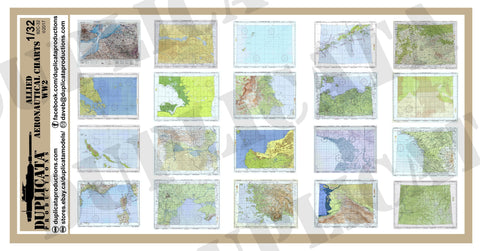
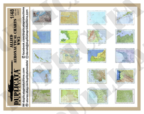
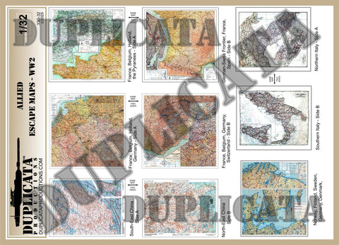
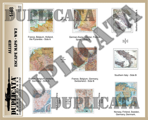
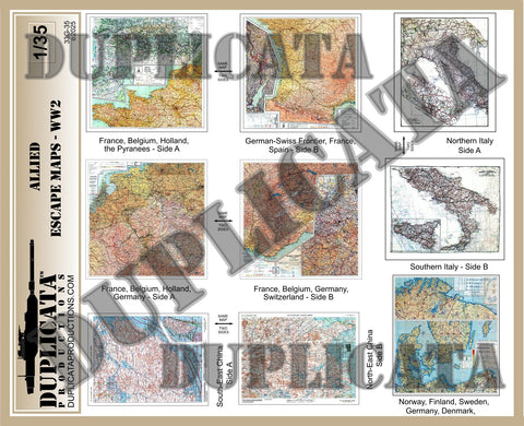
- 5 Allied aviator escape maps . 4 of the maps show both sides, so 9 maps total.
- Maps for: Map 1, Side A - France, Belgium, Holland & the Pyrenees. Map 1, Side B - German/Swiss Frontier, France & Spain. Map 2, Side A - France, Belgium, Holland & Germany. Map 2, Side B - France, Belgium, Germany, Switzerland. Map 3, Side A - South-East China. Map 3, Side B - Nort-West China. Map 4, Side A - Northern Italy. Map 4, Side B - Southern Italy. Map 5 - Norway, Finland, Sweden, Germany & Denmark.
- Maps measure approx. 1" x 1" (2.5 x 2.5 cm). Maps vary in size.
- Sourced from genuine US or British escape maps.
Benefits:
- Quickly and easily add color, visual interest and focal points to any diorama, vignette or model.
- Achieve incredible accuracy with authentic maps actually related to the location depicted in your diorama.
- Thin, strong paper allows bends, creases and folds. Can be dampened with water and realistically moulded or draped.
- Can be weathered with chalk, colored pencils, ink, or paint.
- Can be cut, torn, shredded and even burned to simulate age or damage.
- With so many maps provided, one sheet can be used for many different projects.
We Also Recommend